
 |
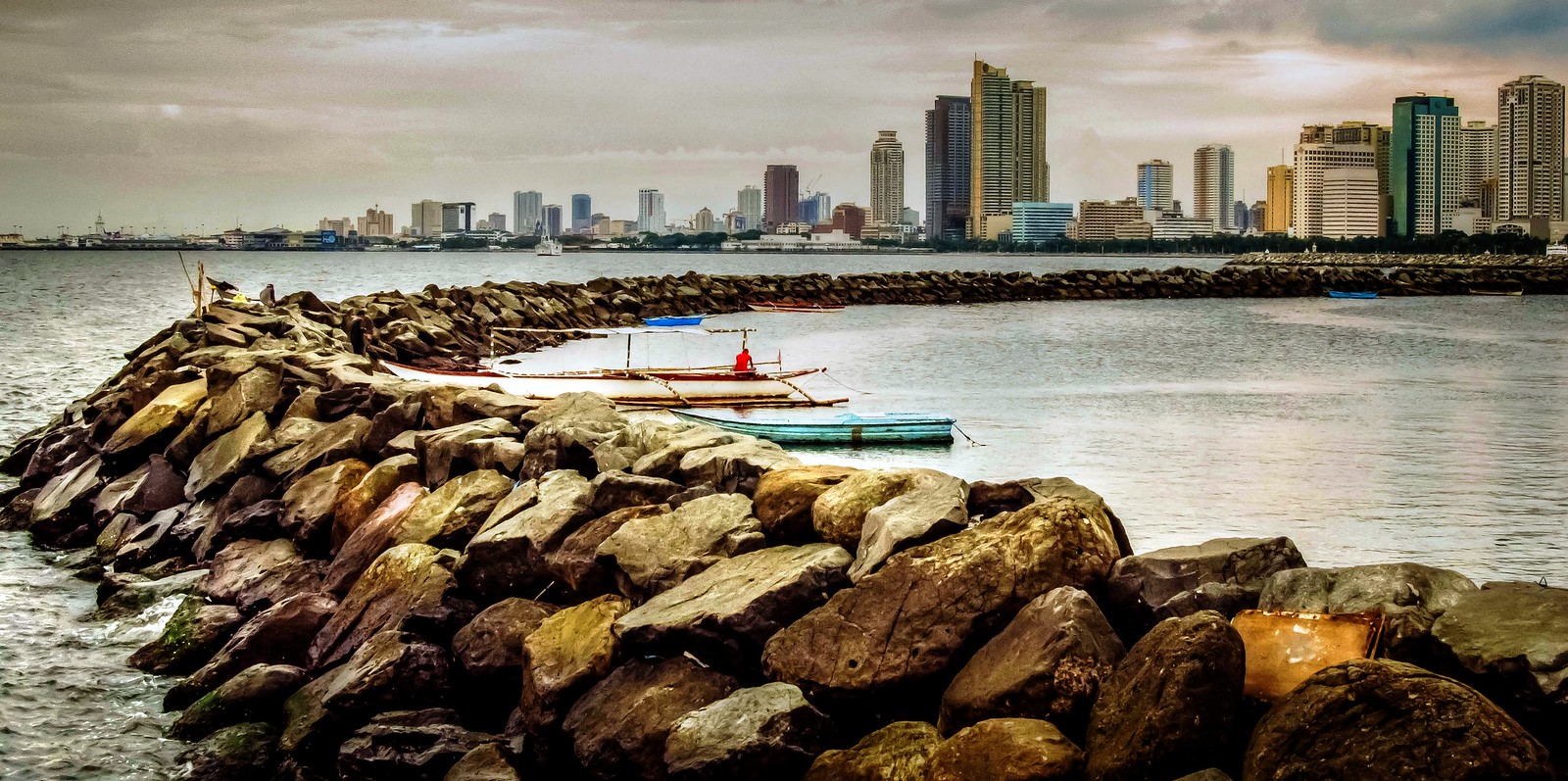
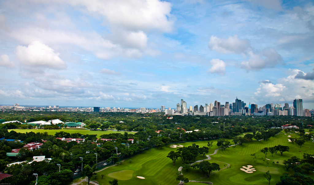 I always pass by these golf course on Mckinley Road. What I remember most was the abundance of huge acacia trees and vegetation that made the place cool. Established in 1901, this is undoubtedly Manila's preeminent golf club. The 18-hole course is impeccably maintained, while the clubhouse features a coffee shop, a restaurant and a gym for the relaxation of members. I always pass by these golf course on Mckinley Road. What I remember most was the abundance of huge acacia trees and vegetation that made the place cool. Established in 1901, this is undoubtedly Manila's preeminent golf club. The 18-hole course is impeccably maintained, while the clubhouse features a coffee shop, a restaurant and a gym for the relaxation of members.We learn more of our true history in our social intercourse on rural justice more than the news/books from the Western Media in our classroom years. We were somewhat brainwashed to think that people who fight to uplift themselves from social oppression were all bad. To look at the true story of the HUK Insurrection in the Philippines, is to open both sides of society, the poor and the rich. |
|

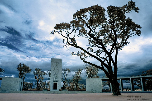
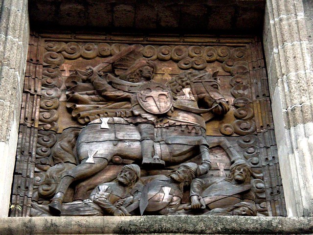
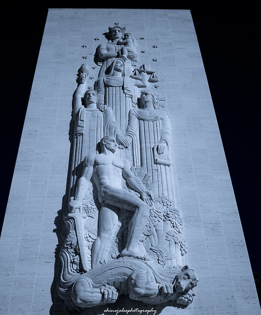 These is located next to our home base at the Navy Village about a mile away. Chapel Sculpture Facade of the 60-ft tall chapel of the American Cemetery in Fort Bonifacio, Taguig City. The sculpture represents, from bottom to top, the young American warrior symbolized by St George, fighting his enemy, the dragon, in the jungle. Above them are the ideals for which he fought: Liberty, Justice, Country. Columbia, with the child symbolizing the future, stands at the zenith. Information sourced from the Manila American Cemetery and Memorial pamphlet.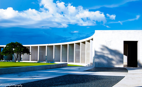 High Noon at the Batttlefield
Right hemicycle of the Manila American Cemetery, viewed from the entrance of the left hemicycle. The gap between the gray pebbles is the path to the memorial's chapel. For more information, please see
 In Memoriam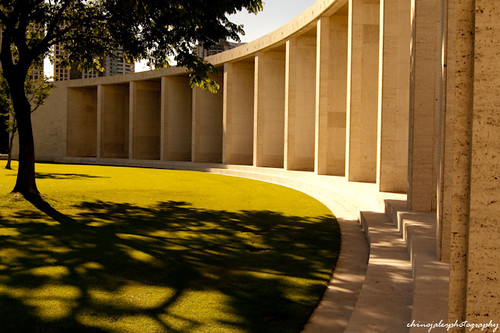 Opposites
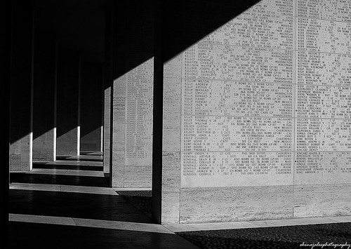
Shot at the Manila American Cemetery. The brownish smooth hardness of the limestone tablets against the dark, disordered patterns of the tree's foliage. Order and disorder. Life. Gone, and the living.
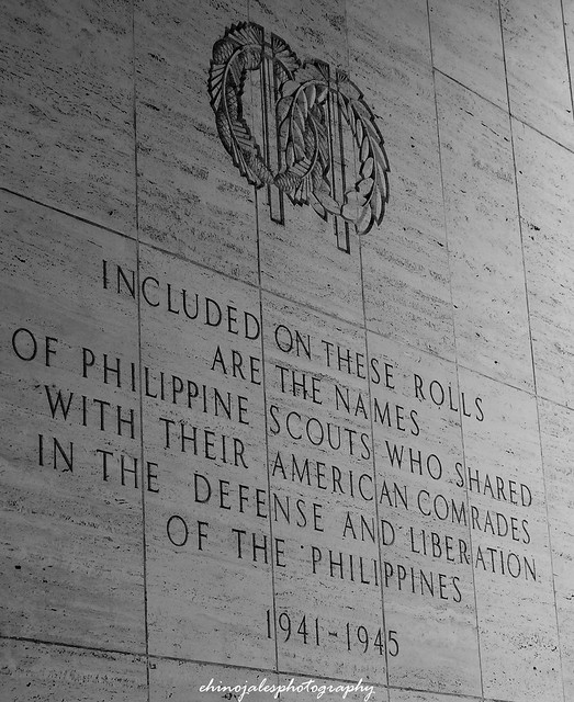
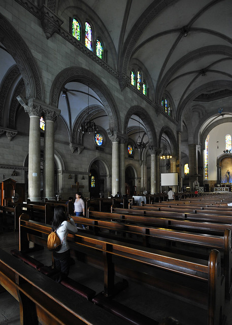
 Wall of the Missing. Continuing with the B&W project. Shot at the Manila American Cemetery in Fort Bonifacio, Taguig City. As the sun gently sinks, the shadows slowly draws across the names of the missing valiant - exactly 36,286 American and Filipino servicemen are recorded in these limestone tablets. Manila American Cemetery and MemorialManila American Cemetery and Memorial is located in Fort Bonifacio, Taguig City in Metro Manila, Philippines.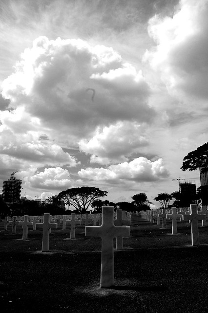 Manila American Cemetery and Memorial Nave Chapel of Our Lady of the Miraculous Medal, Philippine Women's University, Manila, Philippines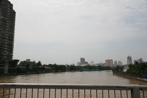 Pasig River viewed from old Ayala Bridge  Puerta de Isabel Gate through the old Spanish Wall, Intramuros, Manila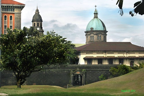 Puerta Postigo del Palacio Gate, Intramuros, Manila, Philippines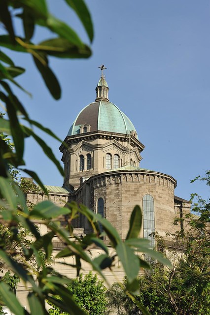 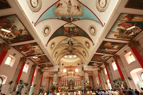 The awesome interior of old Binondo Church ( Basilica of San Lorenzo Ruiz ) .... the patroness of this historic Dominican Church is the Nuestra Senora Del Rosario .  In College, I worked in this building with an export import company. | 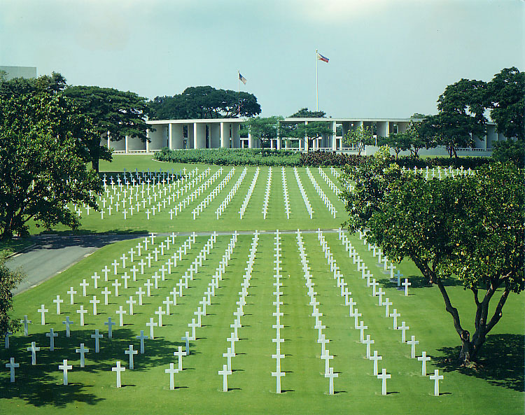   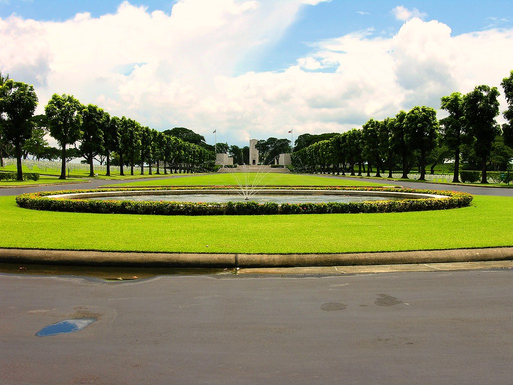
|
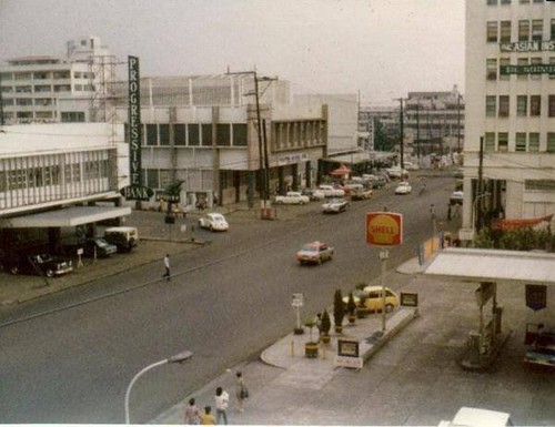
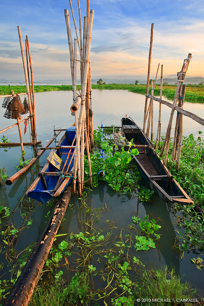
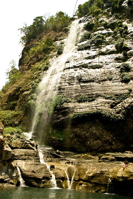 Bomod-ok Falls. Sagada, Mt. Province, Philippines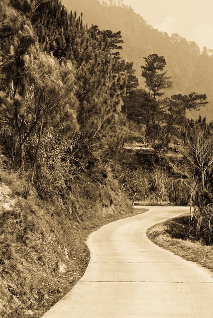 Curvy Road over Mt. ProvinceSagada, Mt. Province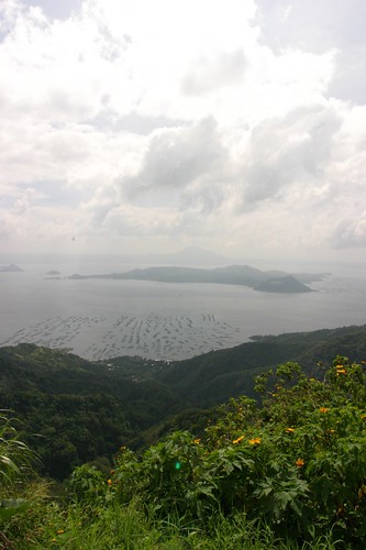 Taal Volcano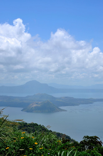 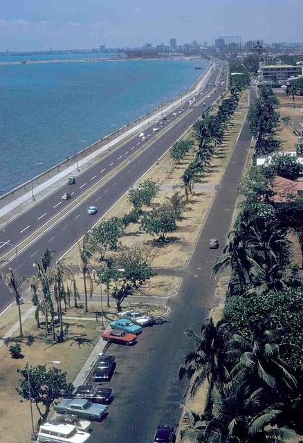 Pasay City, Roxas Blvd. at Aristocrat (Barbecue Plaza)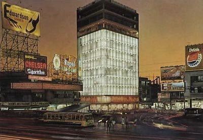 Plaza Miranda-Quiapo 1950's-1970's Metro Manila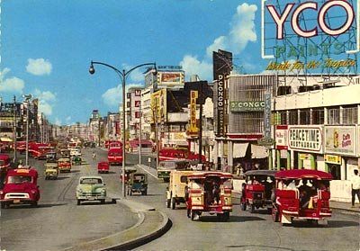 Quezon Blvd.- Quiapo1950's-1970's Metro Manila, Rizal Theater-Makati 1950's-1970's Metro Manila, Philippines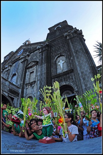 Palm Sunday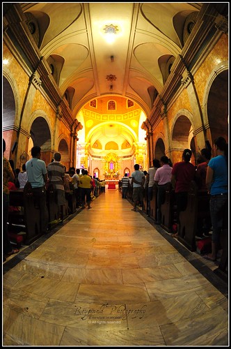
Benediction every Monday afternoon. Our ritual at Espirito Santo Parochial School
|  Before I left for the US we visited Tagaytay for the last time. From the ridge, a magnificent view of Taal can be seen, and Taal lake as the picture above can be accessible by car from the main road.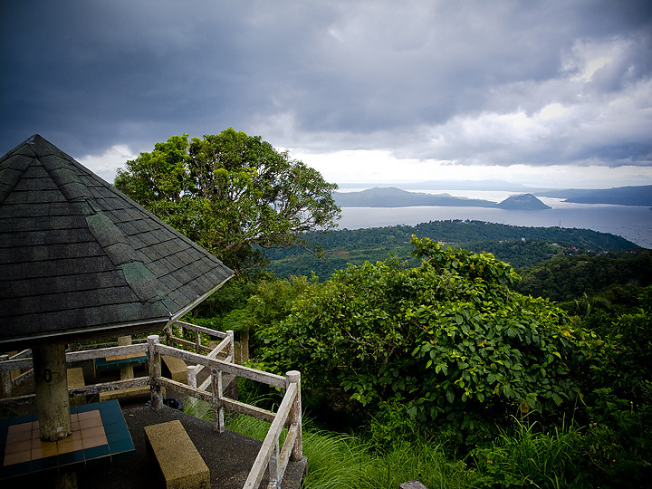 Taal volcano as seen from Picnic Grove on a cloudy day.
Taal Volcano is a complex volcano. Historical eruptions are concentrated on Volcano Island, an island near the middle of Lake Taal. The lake partially fills Taal Caldera, which was formed by powerful prehistoric eruptions between 140,000 to 5,380 BP. Viewed from Tagaytay Ridge, Taal Volcano and Lake presents one of the most picturesque and attractive views in the Philippines. It is located about 50 km ( 31 miles ) south of the capital of the country, the city of Manila.
|
Sangley Point Air Base . My father became the CO of Sangley Point Cavite Naval Base in the 70’s.

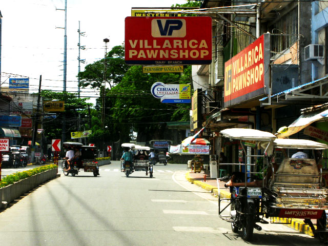
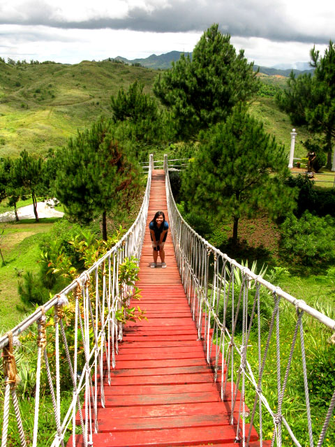
I would be remiss if I do not mention my favorite swimming hole in Tanay, Daranak Falls. Remembering fondly, cherishing memories of early summer vacations spent at this place. This 14-meter high falls is truly a refreshing site. A short walk over the top of Daranak are smaller, cascading streams known as Batlag Falls. It is located at Bgy. Tandang Kutyo in the town of Tanay. The place has been transformed into a public park/resort operated by the government.
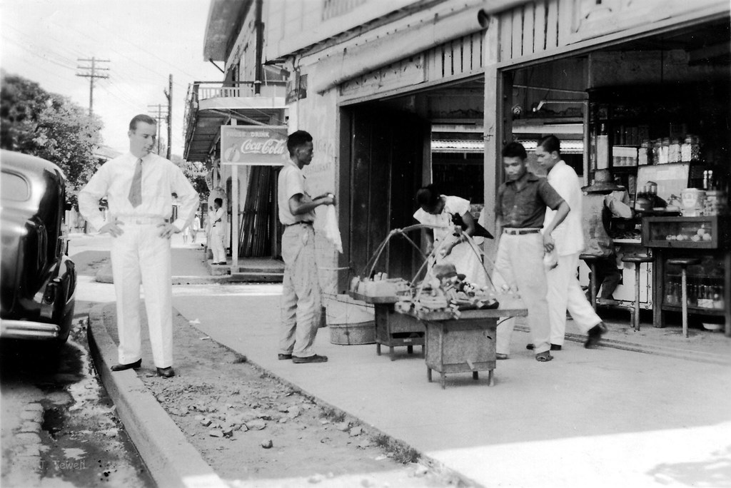
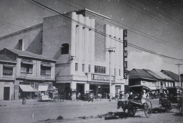
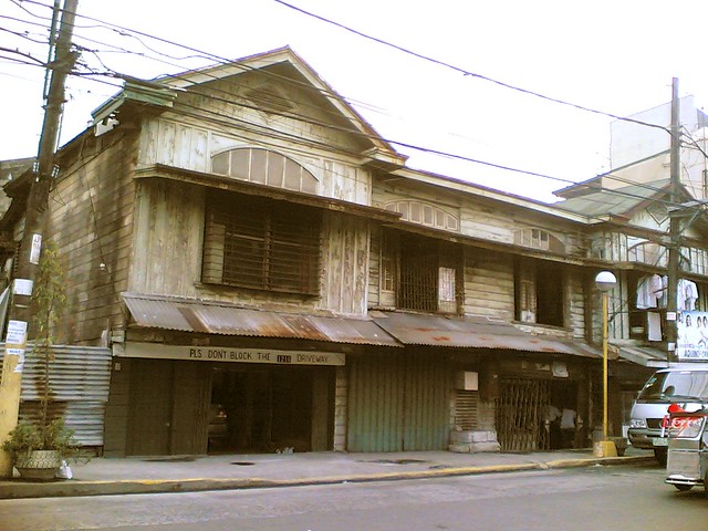
 Aurora Blvd.-Cubao1950's-1970's Metro Manila,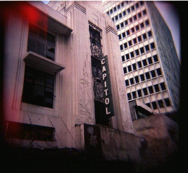 Old Capitol Movie TheaterCapitol Theatre Art Deco in Escolta, Manila. Capitol used to be one of the finest movie houses in the Philippines until the 1960s. A smile shines thru. The Philippine Santa Cruzan celebration is held each month of May. It highlights a religious procession participated in by beautiful ladies, among them a "Reyna Elena." They depict the historic search of the Holy Cross by Queen Helena and her son Constantine the Great. Typical corner cafe and street vendor up front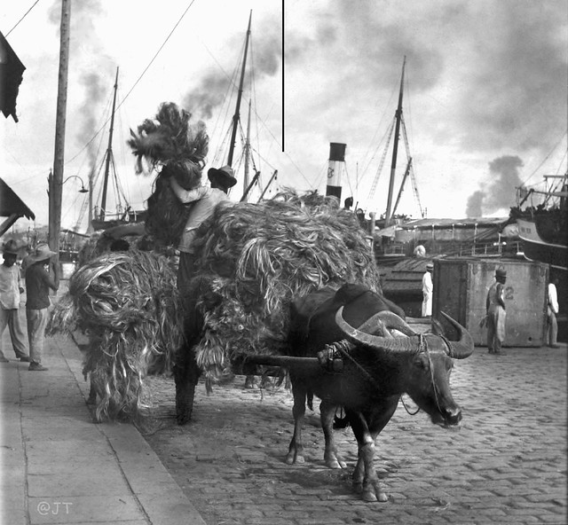 Manila hemp arriving in cart loads at a Manila warehouse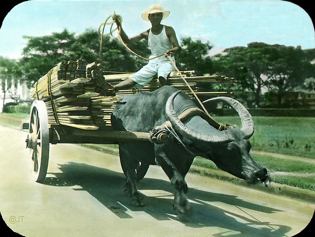 Carabao cart hauling lumber the old energy efficient Filipino way, Manila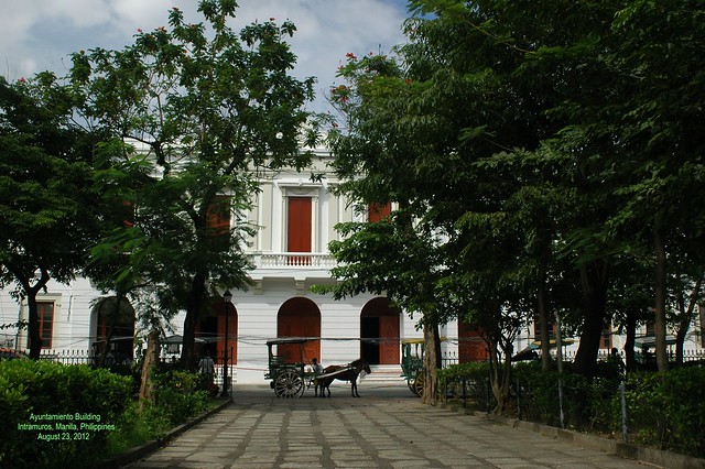 Ayuntamiento Building, Intramuros, Manila |


Independent Philippines and the Third Republic (1946-1972). In April 1946, elections were held. Despite the fact that the Democratic Alliance won the election, they were not allowed to take their seats under the pretext that force had been used to manipulate the elections. The United States withdrew its sovereignty over the Philippines on July 4, 1946, as scheduled.
Manuel Roxas (Liberal Party), having been inaugurated as President as scheduled, on July 4, 1946 before the granting of independence, strengthened political and economic ties with the United States in the controversial Philippine-US Trade Act, In Mar., 1947, the Philippines and the United States signed a military assistance pact (since renewed) which allowed the US to participate equally in the exploitation of the country's natural resources—and rented sites for 23 military bases to the US for 99 years (a later agreement reduced the period to 25 years beginning 1967). These bases would later be used to launch operations in the areas of Korea, China, Vietnam, and Indonesia. During the Roxas administration, a general amnesty was granted for those who had worked together with the Japanese while at the same time the Huks were declared illegal. His administration ended prematurely when he died of heart attack April 15, 1948 while at the US Air Force Base in Pampanga. Vice President Elpidio Quirino (Liberal Party, henceforth referred to as LP) was sworn in as President after the death of Roxas in April 1948. He ran for election in November 1949 against Jose P. Laurel (Nacionalista Party, henceforth referred to as NP) and won his own four-year term. During this time, the CIA under the leadership of Lt. Col. Edward G. Lansdale was engaged in paramilitary and psychological warfare operations with the goal to hold back the Huk Movement. Among the measures which were undertaken were psyops-campaigns which demoralized the superstition of many Filipinos and acts of violence by government soldiers which were disguised as Huks. By 1950, the U.S. had provided the Philippine military with supplies and equipment worth $200 million dollars. The huge task of reconstructing the war-torn country was complicated by the activities in central Luzon of the Communist-dominated Hukbalahap guerrillas (Huks), who resorted to terror and violence in their efforts to attain land reform and gain political power. They were finally brought under control (1954) after a dynamic attack introduced by the minister of national defense, Ramón Magsaysay. By that time Magsaysay was president of the country, having defeated Quirino in Nov., 1953. His campaign was massively supported by the CIA, both financially and through practical help in discrediting his political enemies. He had promised sweeping economic changes, and he did make progress in land reform, opening new settlements outside crowded Luzon Island. His death in an airplane crash in Mar., 1957, was a serious blow to national morale. Vice President Carlos P. García succeeded him and won a full term as president in the elections of Nov., 1957. In foreign affairs, the Philippines preserved a firm anti-Communist policy and joined the Southeast Asia Treaty Organization in 1954. There were difficulties with the United States over American military installations in the islands, and, in spite of formal recognition (1956) of full Philippine sovereignty over these bases, tensions increased until some of the bases were dismantled (1959) and the 99-year lease period was reduced. The United States rejected Philippine financial claims and projected trade revisions. Philippine opposition to García on issues of government corruption and anti-Americanism led, in June, 1959, to the union of the Liberal and Progressive parties, led by Vice President Diosdado Macapagal, the Liberal party leader, who succeeded García as president in the 1961 elections. Macapagal’s administration was marked by efforts to combat the mounting rise that had plagued the republic since its birth; by attempted alliances with neighboring countries; and by a territorial argument with Britain over North Borneo (later Sabah), which Macapagal claimed had been leased and not sold to the British North Borneo Company in 1878.
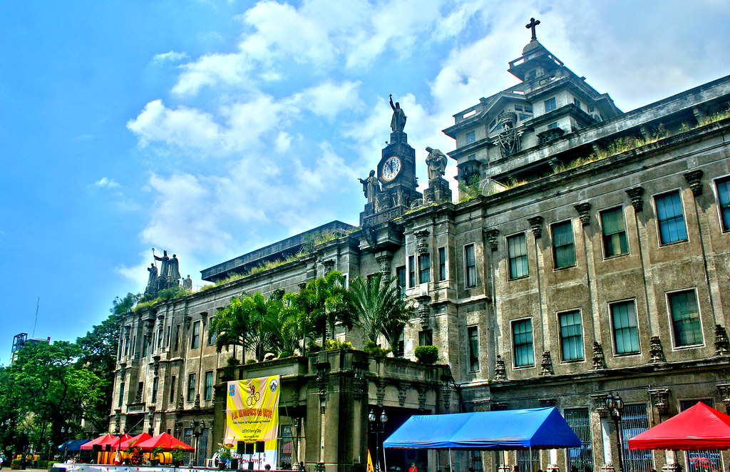
Inside the walls of Intramuros, The location of MIT.One of the seven Gates. The construction of Intramuros started in 1571 by Miguel Lopez de Legaspi, a Spaniard. The walled city covers an area of about 160 acres. Intramuros was a fortress city with walls 6 metres high and a commanding 3 kilometres in length, it is no wonder it was impenetrable. Only the Spanish elite and Mestizos (mixed race) were permitted to live inside Intramuros, where at night the city gates were locked down.
  Intramuros, Manila cathedral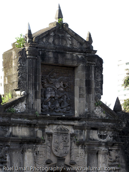
The natives and Chinese were not permitted to live inside the walled fortress and were resigned to live outside the great walls of Intramuros. Intramuros was designed with 51 blocks within the vast walls, the only access in or out of Intramuros was via seven fortified gates. A moat around the walled city was added in 1603. Spread throughout the 51 blocks of the city were 12 churches, hospitals, domestic accommodation, military barracks, Governors Palace and schools.

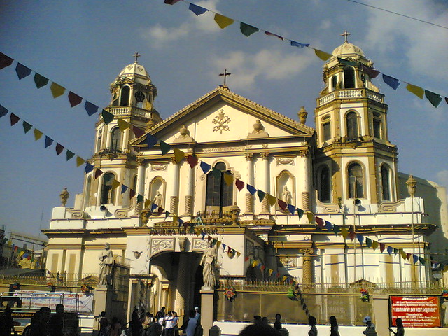
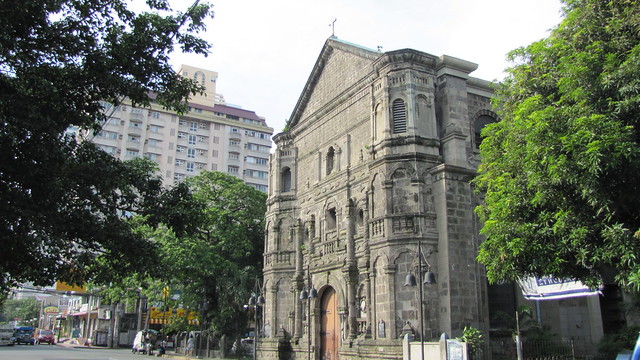
My Church in the town of my birth:Tanay, Built in 1778, the church was named after the Archbishop Ildefonso of Toledo, Spain, who was consecrated during the year 657 AD; revered for his spiritual vitality and deep writings contained in “ The Book of the Virginity of Maria”. Behind the heavy stone edifice decorated with Hispanic, archetype windows and stone sculpture of its saint, are legends that found its way to this generation. Tradition has it that an image of the Lady of the Immaculate Conception, was found among the belongings of our fleeing forefathers on the onset of the Spanish Invasion in 1573; the same image found among the remnants from the fire that gutted the first church in 1620- a lone survivor! During the Chinese Uprising in 1639, Father Geronimo de Frias hid it in the fields but was later on found by the Chinese rebel who tried to destroy the image, instead to themselves befell violent death.
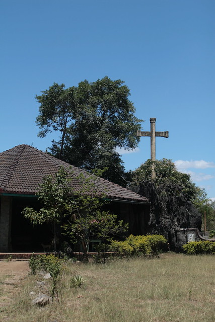
Cross at Bukal, in Tanay
This was always sang to me by my grandmother. Presented in this video are the vintage photographs of the following colonial and historical religious edifices:
1. La Loma Church - formerly Caloocan, now Manila
2. Sto Domingo Church- Intramuros (destroyed by the Americans during world war II) 3. Paco Catholic Cemetery - Paco 4. Tondo Church -Tondo 5. San Sebastian Church -Manila 6. Binondo Church - Binondo 7. San Juan Church - San Juan 8. Sta. Cruz Church - Manila 9. Manila Cathedral - Intramuros 10. Poong Nazareno Church - Quiapo
Television was introduced in the Philippines in 1953 with the opening of DZAQ-TV Channel 3 of Alto Broadcasting System in Manila. The station was owned by Antonio Quirino, the brother of the incumbent Philippine president, who was set to run for re-election the following year. The station operated on a four hour-a-day schedule (6 - 10 p.m.) and telecast only over a 50-mile radius. This television station was later bought by the Chronicle Broadcasting Network which started operating radio stations in 1956. CBN was owned by the Lopezes who were into various business concerns. The acquisition signalled the birth of ABS-CBN Broadcasting Network, now considered one of the major broadcasting companies not only in the Philippines but also in Asia. The Lopezes also owned The Manila Chronicle, a leading daily at that time. ABS-CBN therefore became not only the first radio-TV network in the Philippines but also the first cross-media entity owned by a family --- a situation which remains until today. Subsequently, the Lopez group added a second station, DZXL-TV 9. By 1960, a third station was in operation, DZBB-TV Channel 7 or Republic Broadcasting System, owned by Bob Stewart, a long-time American resident in the Philippines , who also started with radio in 1950. The first provincial television stations were established in 1968 in Cebu, Bacolod, and Dagupan by ABS-CBN. The network is supplemented by 20 radio stations located nationwide.
Economic constraints during these early years of television forced a dependence on imported programs from three U.S. networks – ABC, CBS, and NBC. Importing programs was cheaper than producing them locally. In addition, canned programs appeared to be more popular among local audiences, even though initiatives were made in educational programming.
The commercial thrust of Philippine broadcasting has made it unique among other East Asian countries, where the electronic media are controlled and operated by the government. While this free enterprise environment made local broadcasting globally competitive, the same environment made it difficult to produce and broadcast public service and "development" oriented programs.
Philippine television's early dependence on US programs may be partly responsible for "colonial mentality" that has continued to afflict Filipinos during the past several generations. The commercial orientation of TV also engendered a "that’s entertainment" mentality in both the advertisers and the general public.
|
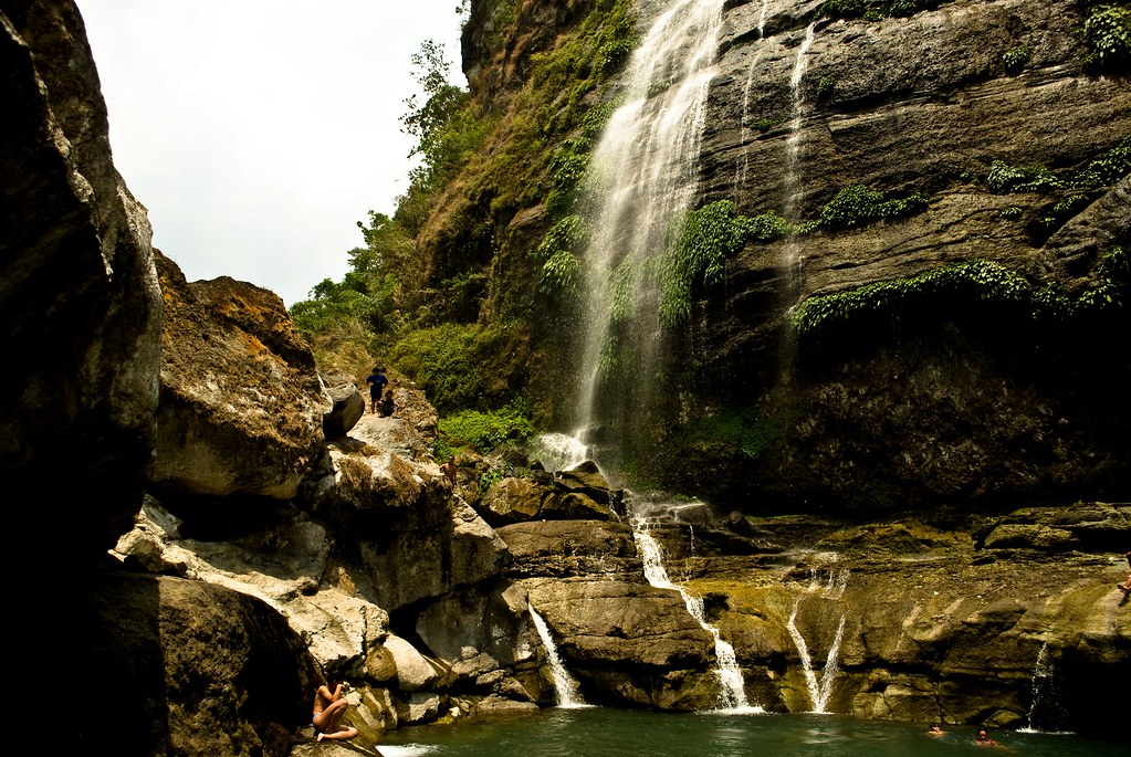 Bomod-ok Falls
|


Sarmiento Bldg, Makati, where I worked at Procter & Gamble;
 ARISTOCRAT. The closest restaurant to our place at MNS. 432 San Andres St. cor. Roxas Blvd., Malate |  
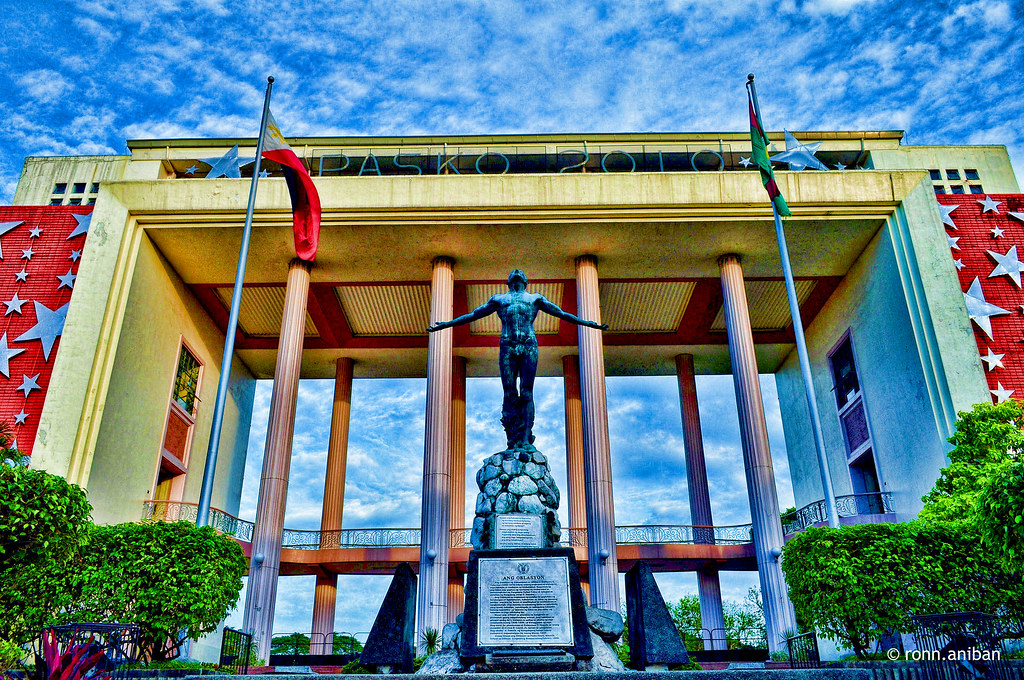
Top, movie houses, City Hall,
Right Photo Bagiuo, the terraces and the Lost highway bontoc-mainit (mountain province). A mountain trail in the Cordillera, Philippines.
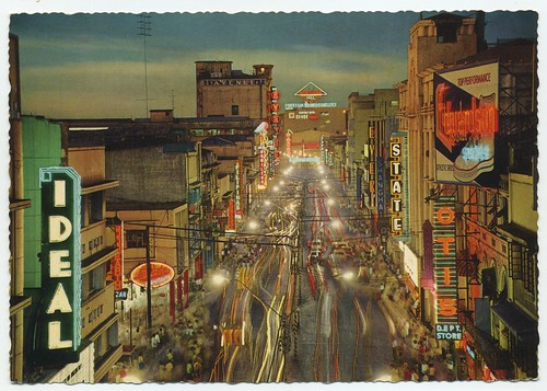
Rizal Avenue the street was named after Rizal, it was referred to as Calle Dulumbayan. I watched movies at the Ideal, State, Dalisay and Avenue Theaters. Later on ... the Universal Theater and Odeon and Galaxy. And Scala, Apollo, Alegria and Opera House.
 |
The Philippines offers the traveler diverse cultures, varied scenery, a rich history, endless activities and, foremost, a welcoming people. From the electric chaos of the capital city of Manila to the serenity of the island of Cebu and the other 7,106 islands, the Philippines has something for everyone.In spite of invasions, oppressions and hardships they’ve suffered, the Filipinos have never lost their feelings of goodwill toward other people and their faith in God. The Philippines is still a well-kept secret, let this Travelscope's video take you to the Philippines.
No comments:
Post a Comment